Traditional social media platforms don’t let you interact with people and businesses you aren’t already connected with, who’re sharing a common experience at the same place and at the same time.
So imagine watching a live game in a stadium with thousands of spectators — assuming that everyone in the stadium isn't already your "friend" or "follower" — there's no simple way for you to share your perspective on the game with fellow spectators (or see their's) in real-time. Furthermore, to order food at the game and check-in at your barber afterwards, you'll still need a few apps.
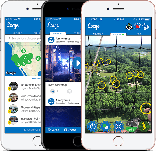
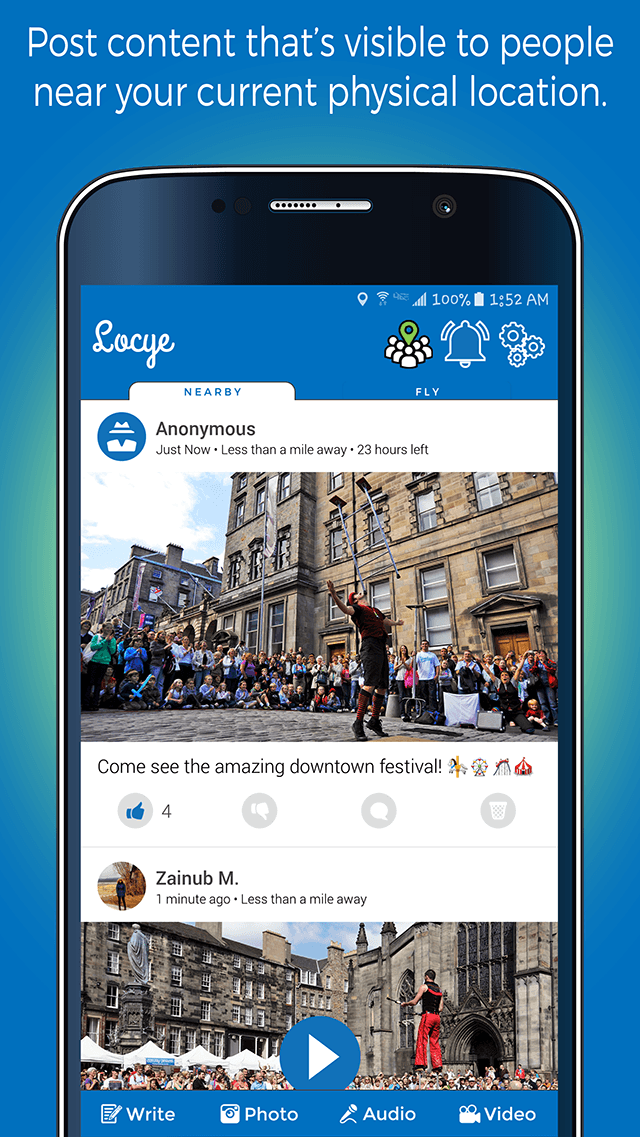
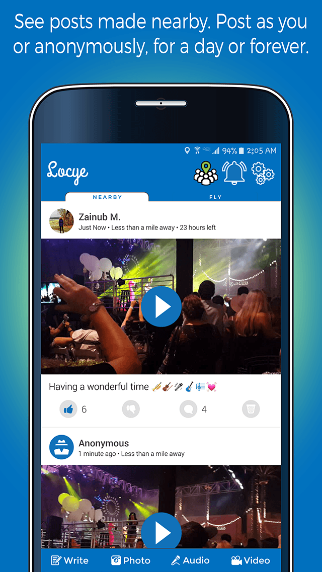
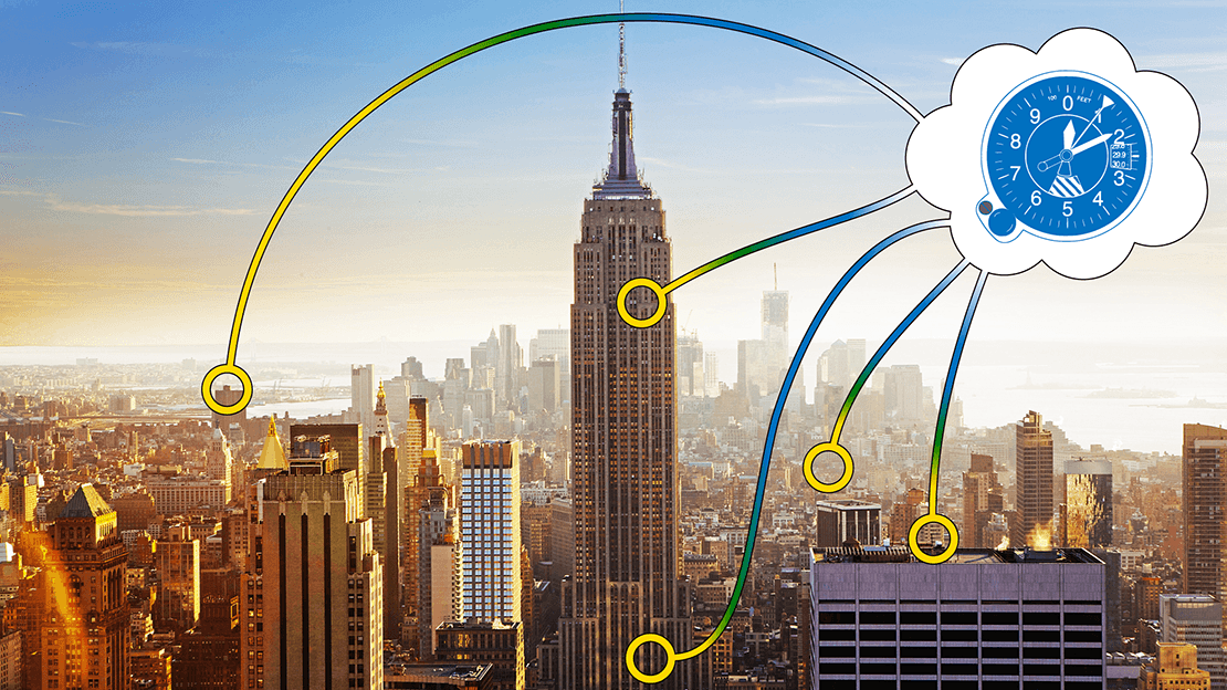
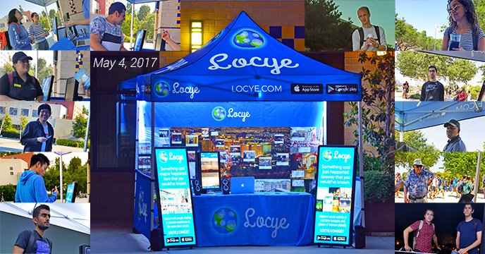
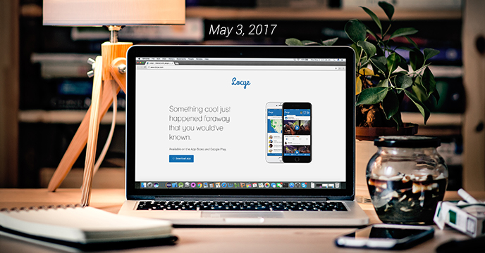
Introducing Locye, a context-aware interactions platform that lets you post content that's visible to people near your current physical location, see posts made near you, and interact with brands you're currently experiencing.
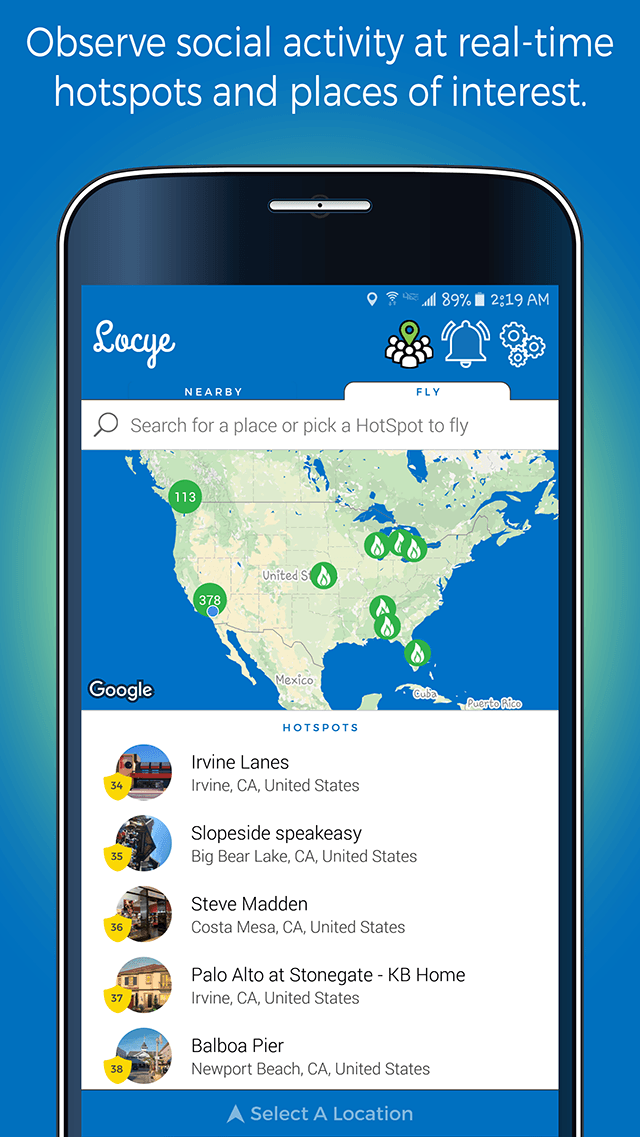
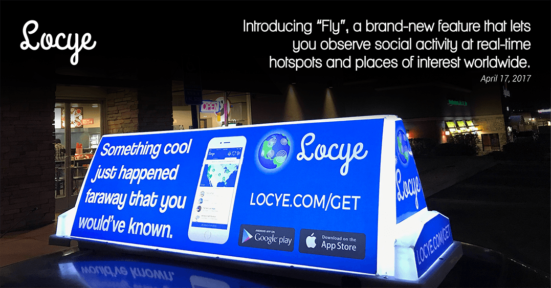
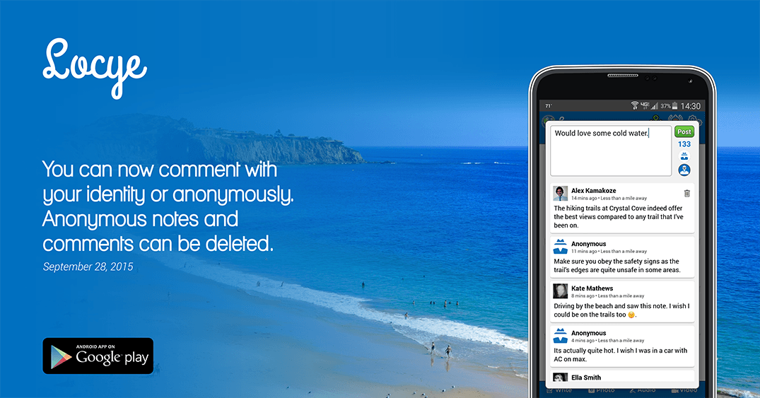
Locye also lets you observe social activity at real-time hotspots and places of interest worldwide. You can post anonymously or with your identity and can have your posts disappear after a day.
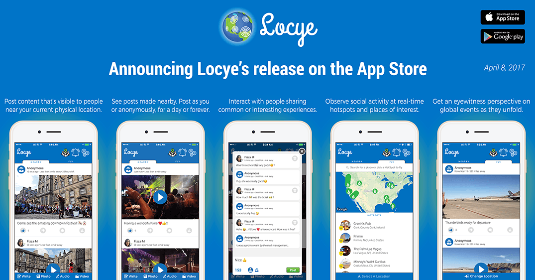
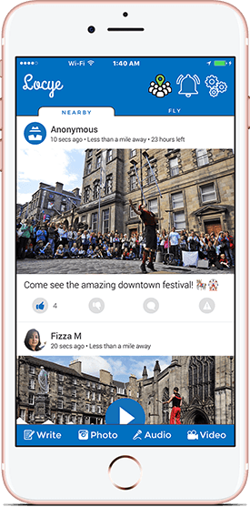
Post content that's visible to people near your current physical location and see posts made by others nearby.
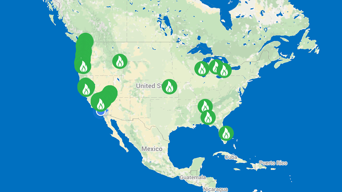
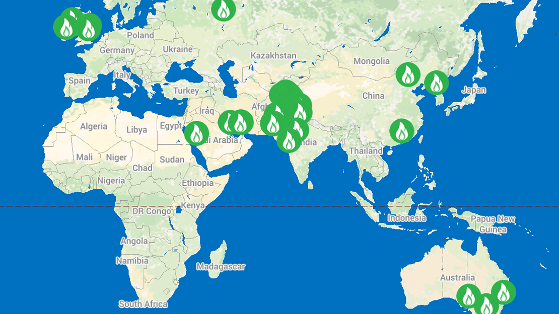
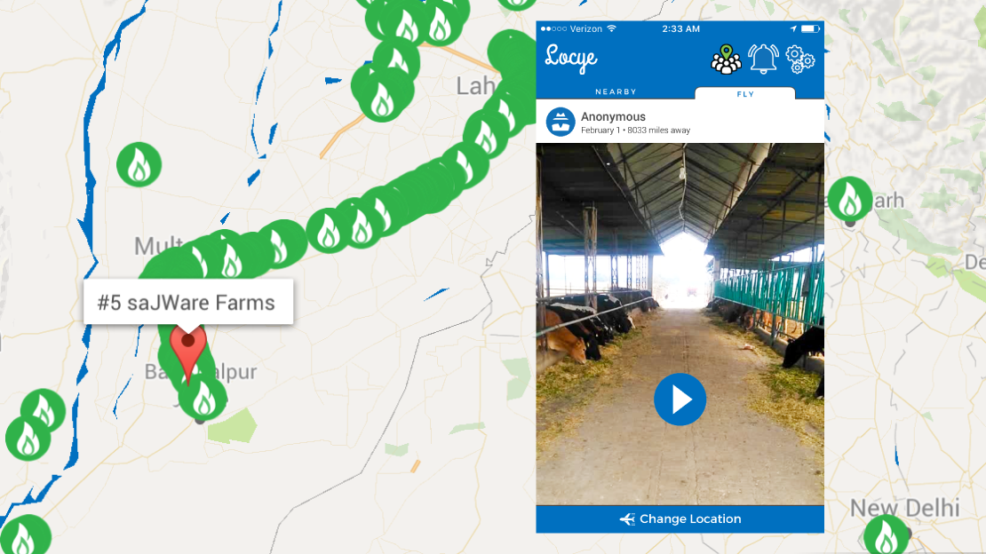
Observe social activity at real-time hotspots and places of interest worldwide.
Discover up to the minute content including posts by citizen journalists at places with the most active usage.
Post content anonymously or with your identity. Toggle between anonymity and your identity with a single tap.
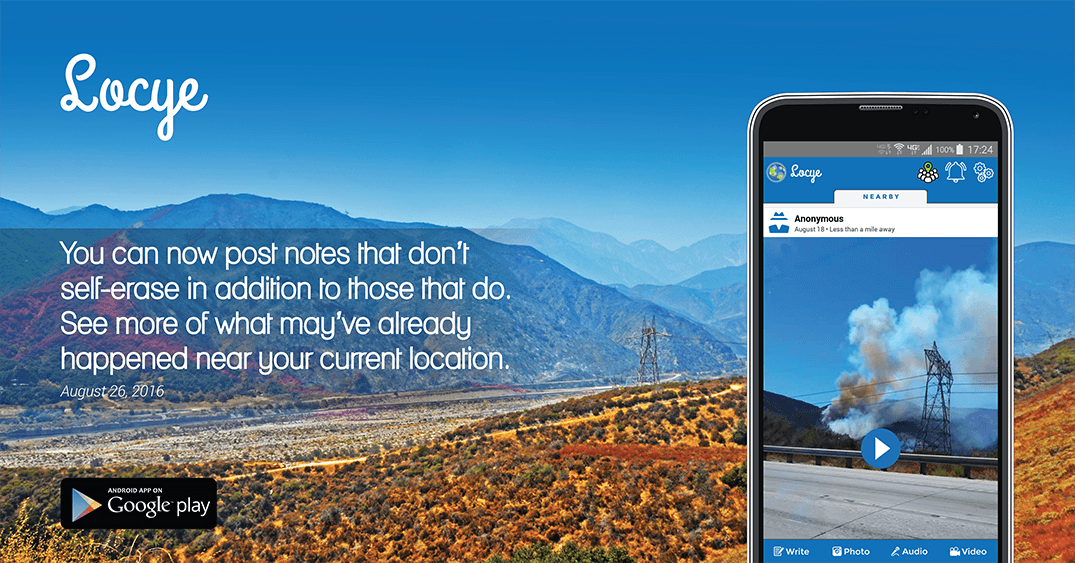
Post your content forever or, with a single tap, mark it for automatic deletion after a day.
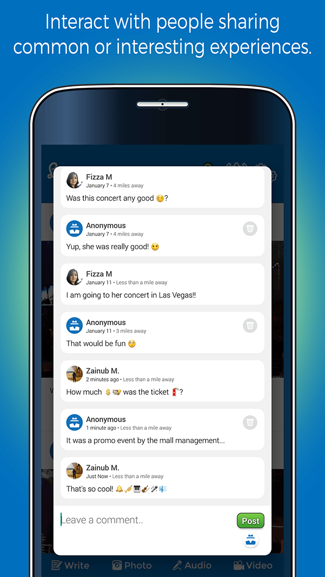
Experience and share rich multimedia content. Like, dislike, and comment on posts. Get feedback notifications.
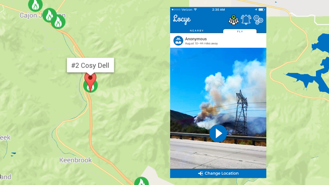
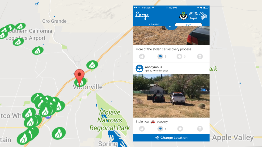
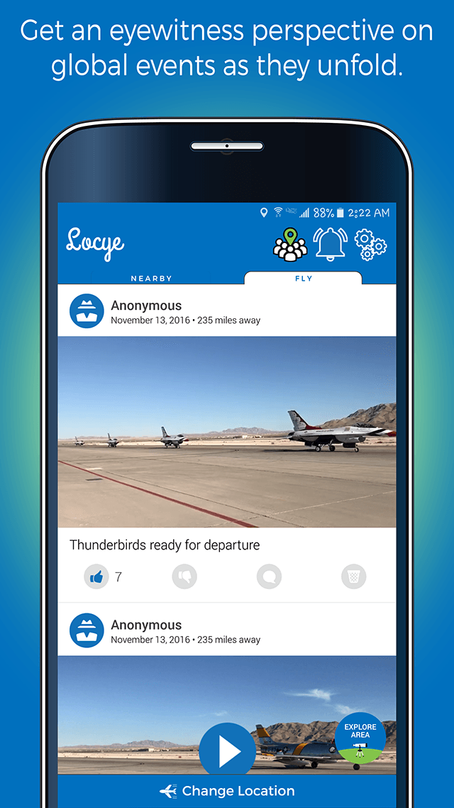
From the Blue Cut fire in Cajon Pass to the Nellis Air Show in Las Vegas and from live concerts in Orange County to car thefts in the High Desert, citizen journalists have already shared it all with people in their vicinity and thousands worldwide.
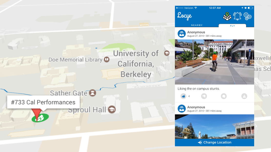
Students are using Locye to engage with their communities like never before. They are already discovering future roommates at USC, voicing their opinions on campus dining at UC Irvine, celebrating the end of finals at KU, and more.
Residents are using Locye to send community level messaging. For example, residents in a Modesto community have shared parking concerns in their community and an Irvine resident informed his neighborhood of a burst water main.
Professionals from various fields are sharing their expertise with their communities. Recently, a doctor shared tips for pediatric ailments prevalent in a South Asian village and a meteorologist shared his insights on a forecasted dust storm.
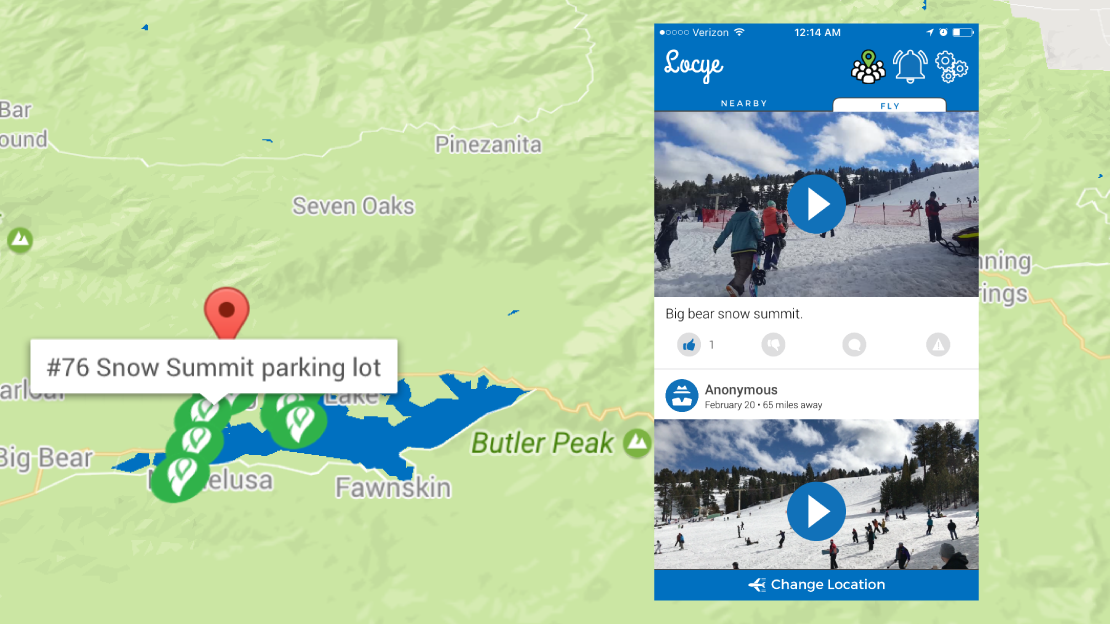
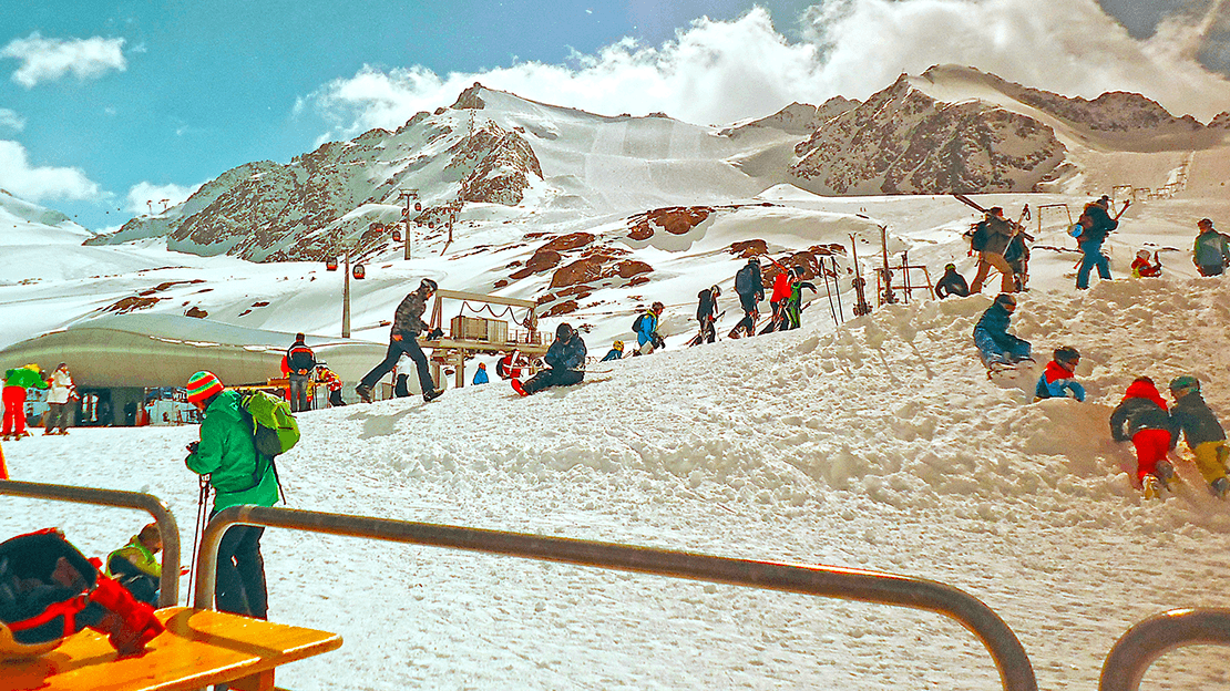
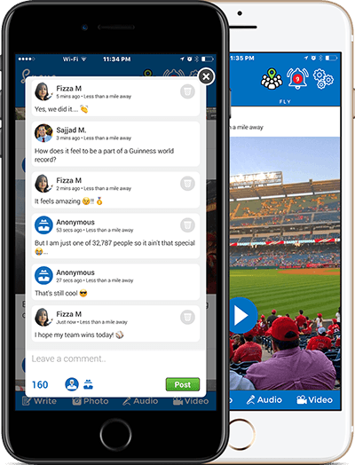
From high school softball fields to giant stadiums — people have used Locye to engage at a new level. They’ve even interacted with each other while attempting a Guinness world record for wearing the most capes at one time at the Angel's stadium.
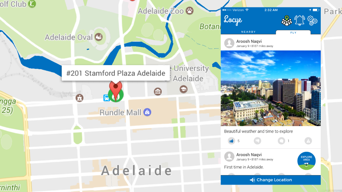
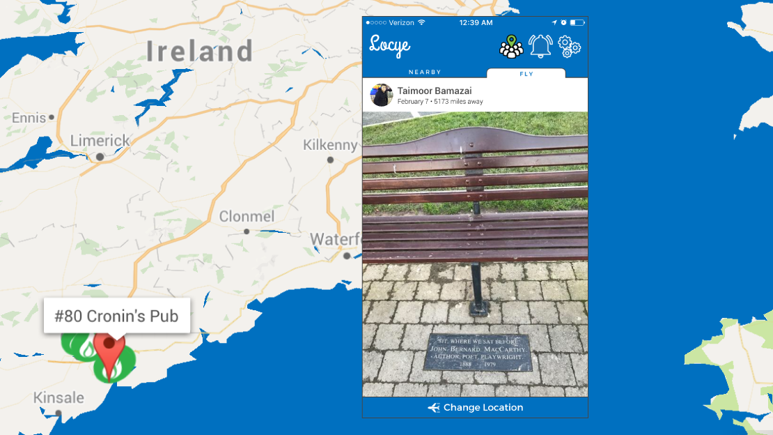
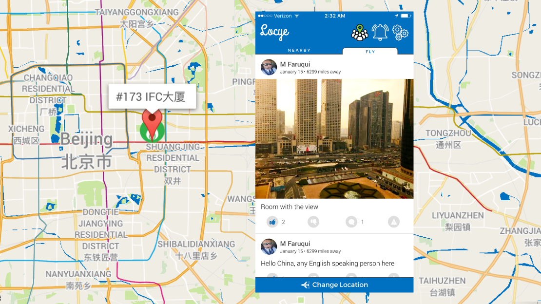
Travelers have caught up with happenings at their destinations, logged their experiences, and safely interacted with the locals. From pilots exploring Adelaide and Beijing during layovers to commuters in London and Dublin, Locye is loved by travelers.
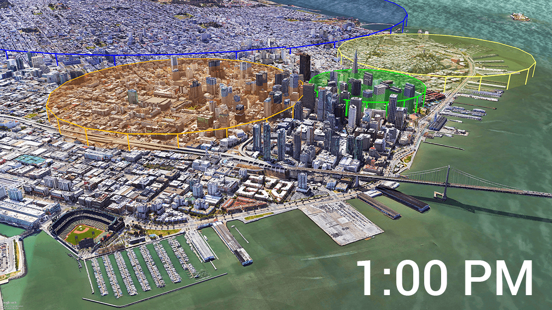
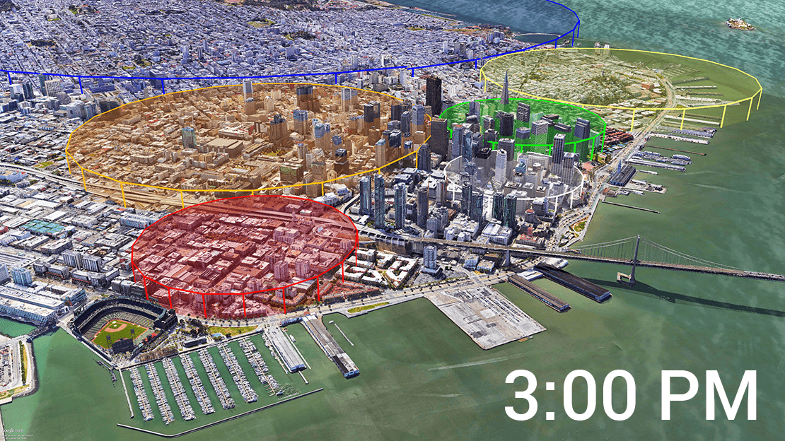
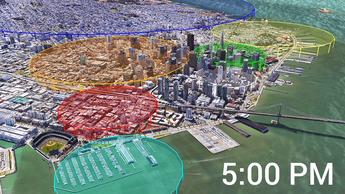
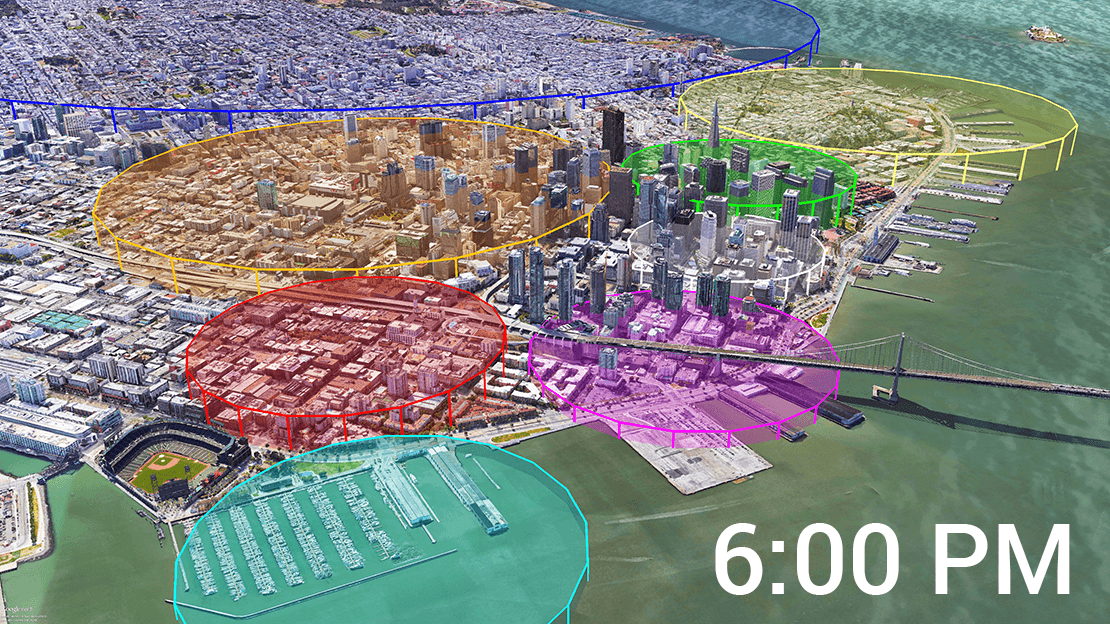
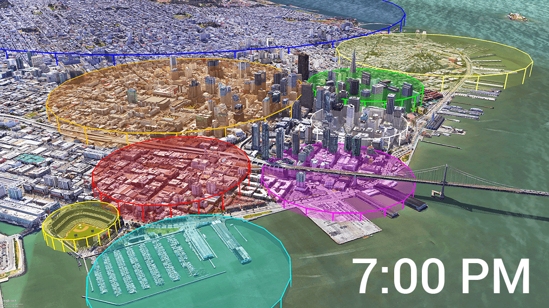
Locye’s Nearby feed displays posts made near your current physical location sorted by recency. Whether you are sitting in a dorm room, traveling in a vehicle at highway speeds, or backpacking near a small desert town, it displays content like any traditional social platform.
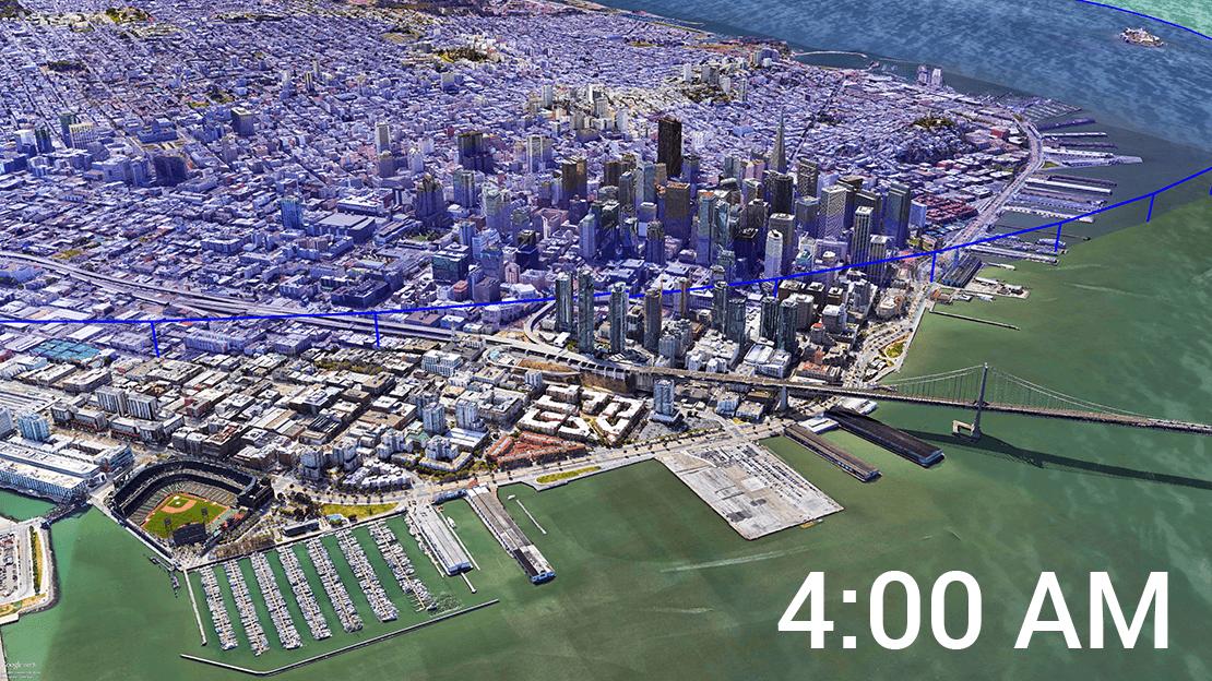
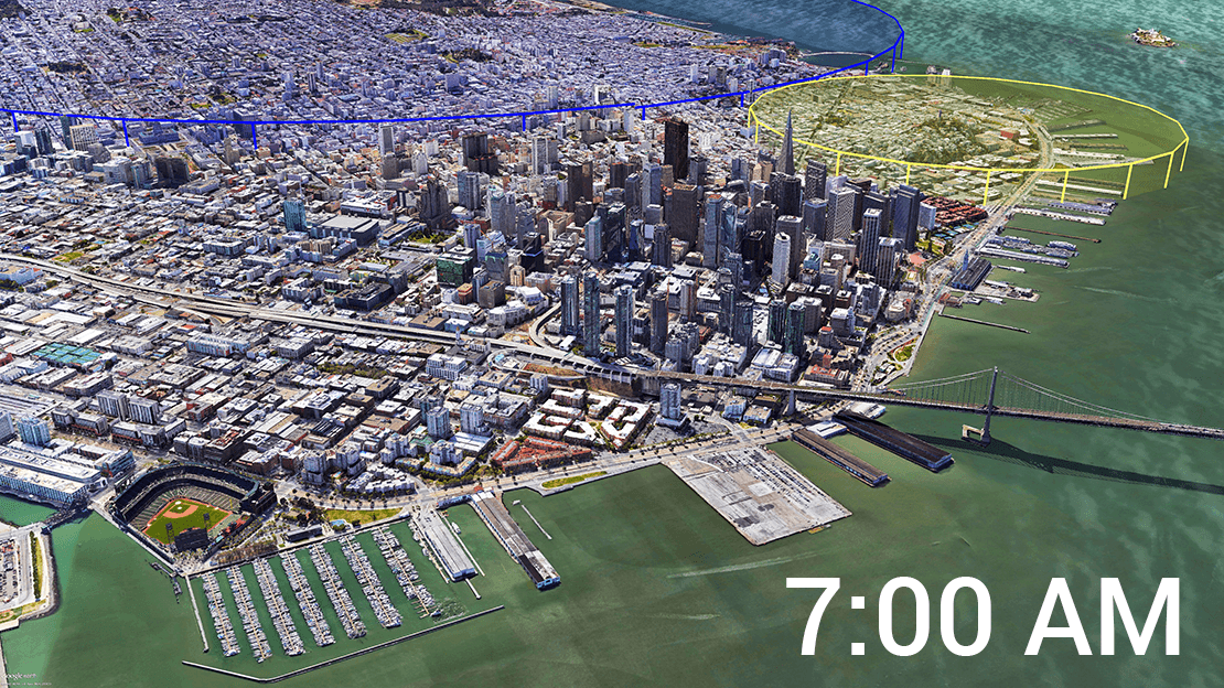
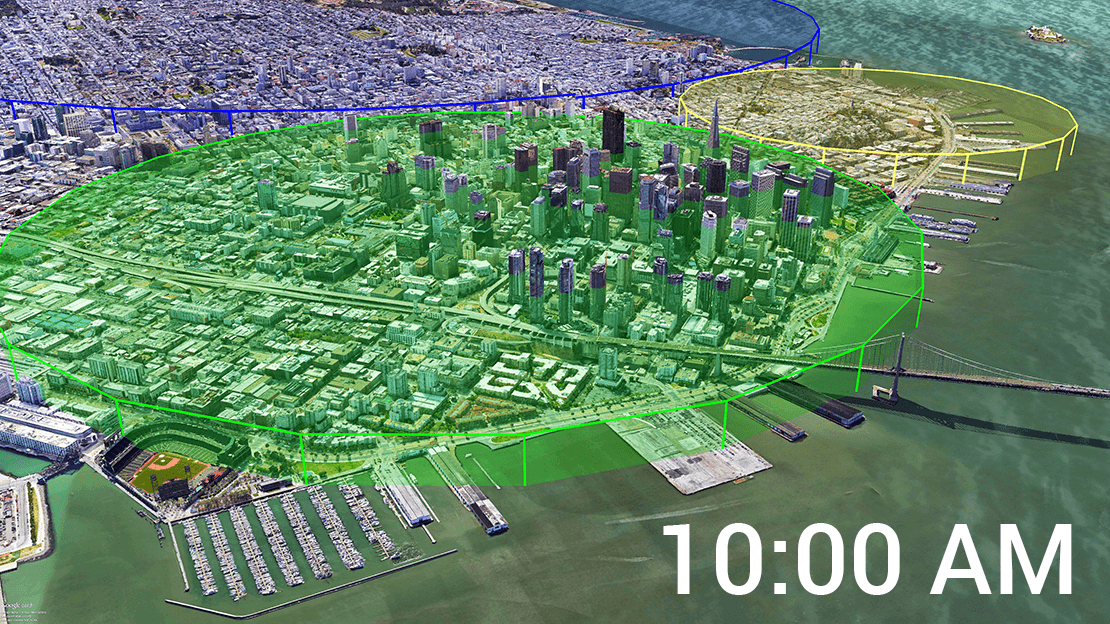
However, unlike traditional social platforms where users are associated with each other via mostly static relationships such as friendships, followers, and/or hashtags; Locye users are associated with each other based on their ever changing proximity. This time and space based nature of associations posed unique challenges to creating and perfecting the Nearby feed.
Through groundbreaking R&D, we’ve developed an extremely scalable, fast, and reliable spatial backend to support our Nearby feed. Amongst the many advances is our ability to adjust on the fly, the radius from which content is fetched for you based on your chronological position in the feed and the amount of social activity in your vicinity at that point in time.
A small but significant amount of content that’s posted on social media contains authentic, first-hand updates that interest a much larger audience than the author intended. A video captured by a local of a flood’s destruction may not just interest the relative for whom it was made; villagers nearby, the national media, and those following the calamity worldwide may want to see it.
Separating such content from the rest and quickly making it visible to all is a challenge. Traditional platforms rely on trending hashtags but they’ve limitations. Posts may not be hash-tagged, use the wrong hashtag, use one of many hashtags for that event, etc. Even with the correct hashtag, there’s no guarantee that only authentic, eyewitness content is using that hashtag.
By leveraging our expertise in analyzing geographic data extremely quickly, Locye analyzes every inch of the globe, every couple of minutes regardless of user load. As a result, it generates a ranked list of the most active spots that are likely to contain authentic, eyewitness content. By letting users observe social activity at these spots, Locye turns into a source of real-time authentic, eyewitness content from around the world.
Locye’s mission is to revolutionize ‟context-aware interactions” i.e. interactions that exist due to an individual’s context and where ‟context” refers to any combination of time, location, activity, identity, and environmental factors.
While creating the Locye platform, we’ve invested thousands of hours in design, development, and testing to not only hone the art of nurturing context-aware interactions across a wide range of use cases but to also attain an unrivaled ability to identify and create unprecedented opportunities for such interactions across enterprises.
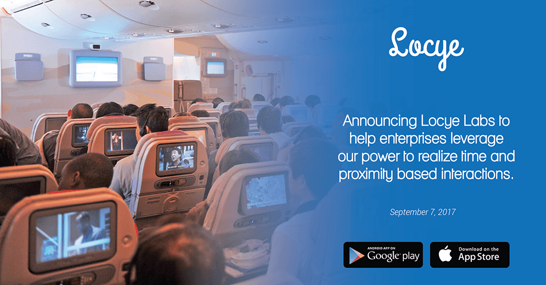
Locye Labs aims to help enterprises leverage context-aware interactions in support of their missions using our products and expertise. While we’re proud to be already working with some of the largest brands in the world, here are some ways in which we could work with your enterprise:
Locye can be private labelled for use within your enterprise. The user interface and functionality can be customized to your needs.
Spatial analytics and facts derived from spatial statistics can be provided for your time-series spatial datasets.
Features and content that let users physically present at your locations to exclusively interact with your brand without needing other apps.
Certain geospatial data and web services that power the Locye ecosystem can be licensed for your enterprise projects.
Certain Locye components can be licensed for inclusion in products and services created by your enterprise to support your core mission.
Locye can be repurposed to support missions involving large-scale, time and proximity based interactions.
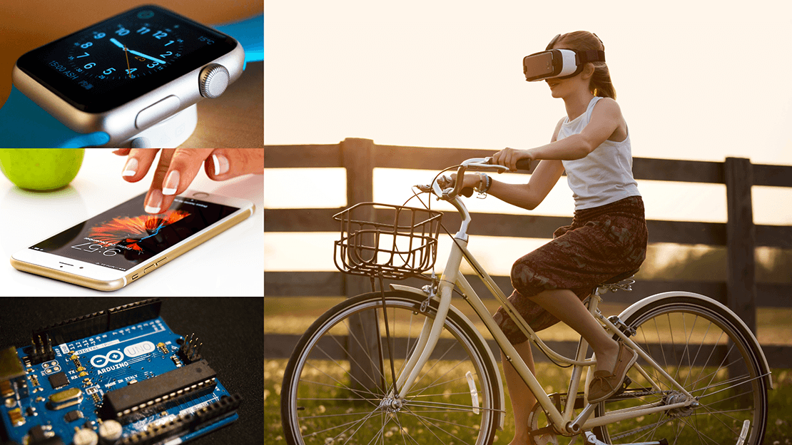
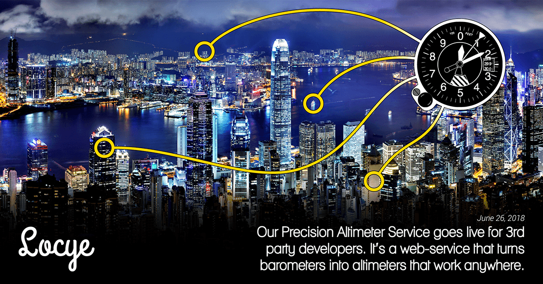
As location-enabled, connected devices become ubiquitous; advancements in technologies such as AR, AI, Mobile, Wearables, and IoT are being continuously leveraged to create new location-based applications that tackle use cases across a wide range of industries. This has led to an ever-greater need for precise location information.
While technologies such as GPS, low-energy Bluetooth, Wi-Fi, and cellular have led to vast improvements in horizontal accuracy of location information; there's a significant room for improvement in vertical accuracy. Locye's Precision Altimeter Service is a step in that direction.
It is a location-based, technology-agnostic, planet-scale web-service that, within its coverage area, can translate air pressure data captured by digital barometers - such as those already prevalent in most modern smartphones - into true altitude above mean sea level. It is available to third party developers (see documentation) and can be integrated using only a few lines of code.
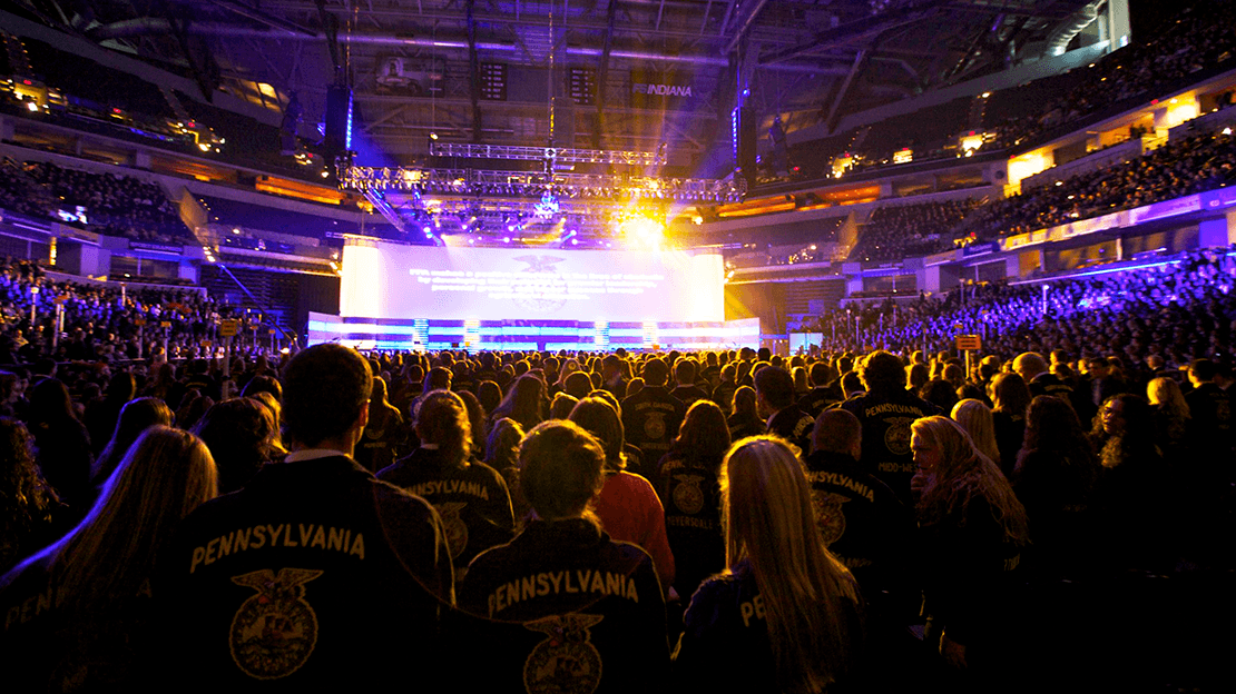
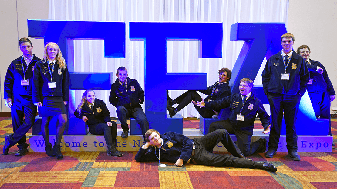
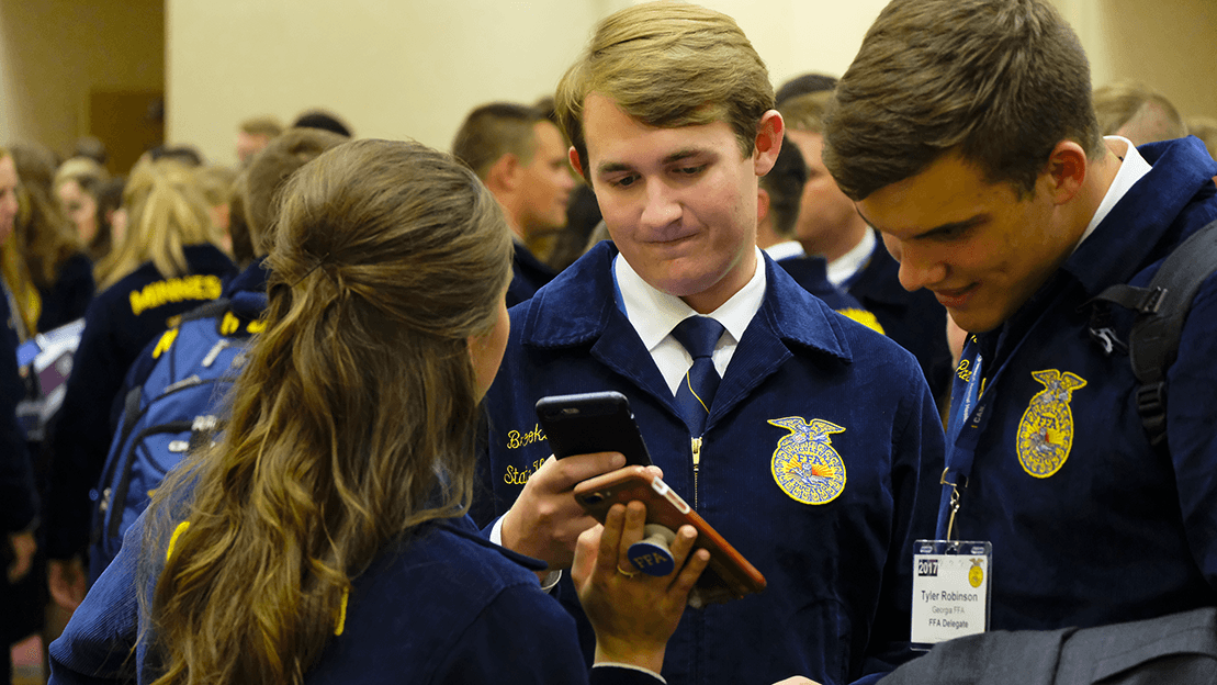
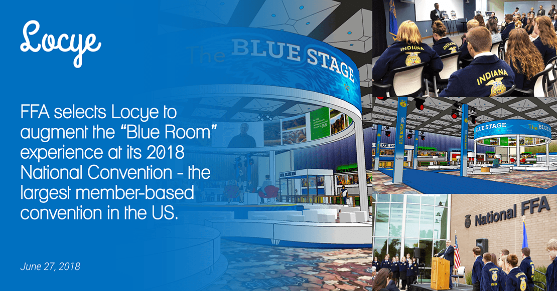
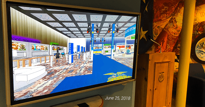
Since 1928, FFA has been making a positive difference in the lives of students by developing their potential for premier leadership, personal growth, and career success through agricultural education. Among other initiatives, today’s FFA helps its members prepare for careers in agbiosciences, natural resources, forestry, and other diverse fields such as technology and information services. Through 8,568 local chapters throughout the U.S., Puerto Rico, and the U.S. Virgin Islands, FFA has 653,359 student members in grades 7 through 12.
Locye has been selected to augment the FFA's "Blue Room" experience at its 2018 Annual Conference and Innovation Showcase event - the largest member-based convention in the United States. We will be leveraging enterprise variants of several upcoming and existing capabilities to create unprecedented opportunities for context-aware interactions at this event.
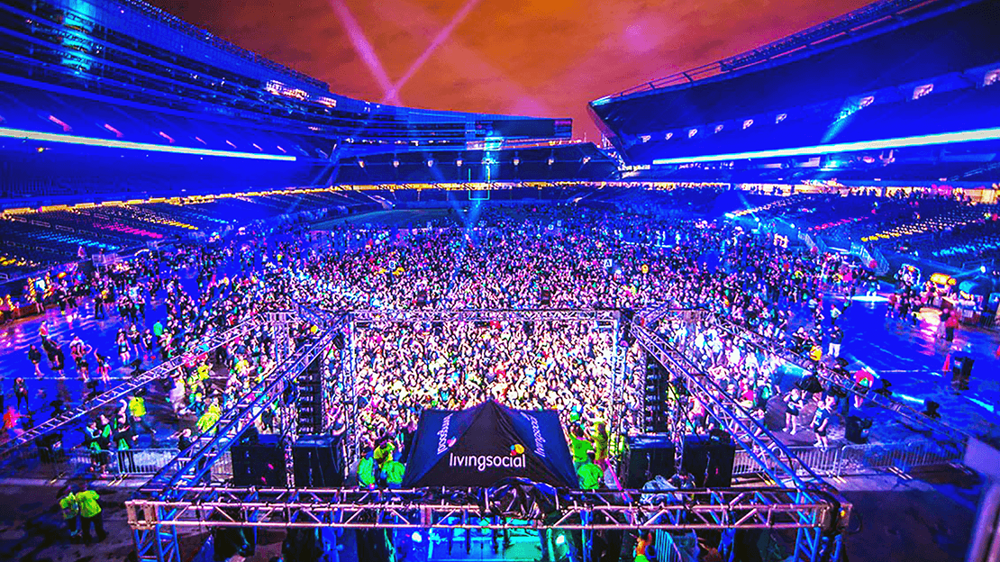
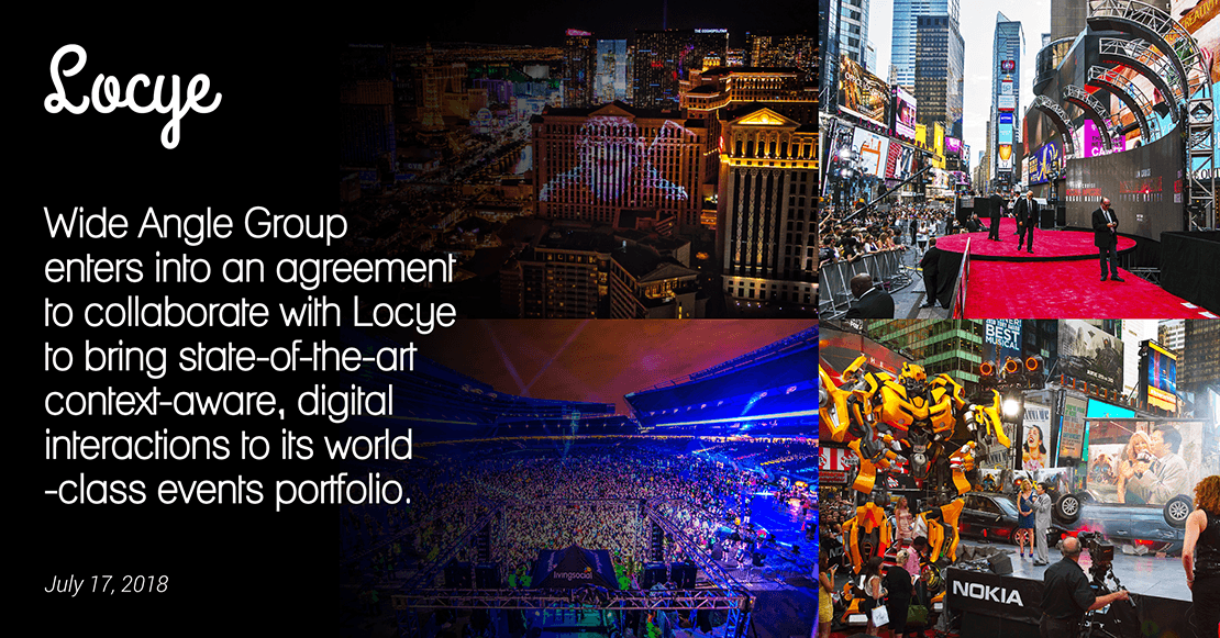
Los Angeles based Wide Angle Group (WAG) is a leading event management company that brings to life, visionary ideas through transformative events for some of the biggest names in sports, entertainment, technology, and consumer brands including Paramount Pictures, Breeders’ Cup, BMW, Alaska Airlines, DirecTV, Fox Sports, Major League Soccer, NFL, Nordstrom, Pollstar, Rolex, 20th Century Fox, Toyota, T-Mobile, UCLA, and LA Clippers.
Through hundreds of imaginative events and installations, WAG has built a reputation for continuously pushing the envelope in multimedia experiences and has a growing need to augment its creations with context-aware experiences. With its collaboration with Locye, WAG will be leveraging enterprise variants of Locye’s existing and upcoming capabilities to bring the state-of-the-art in context-aware digital interactions to its events.

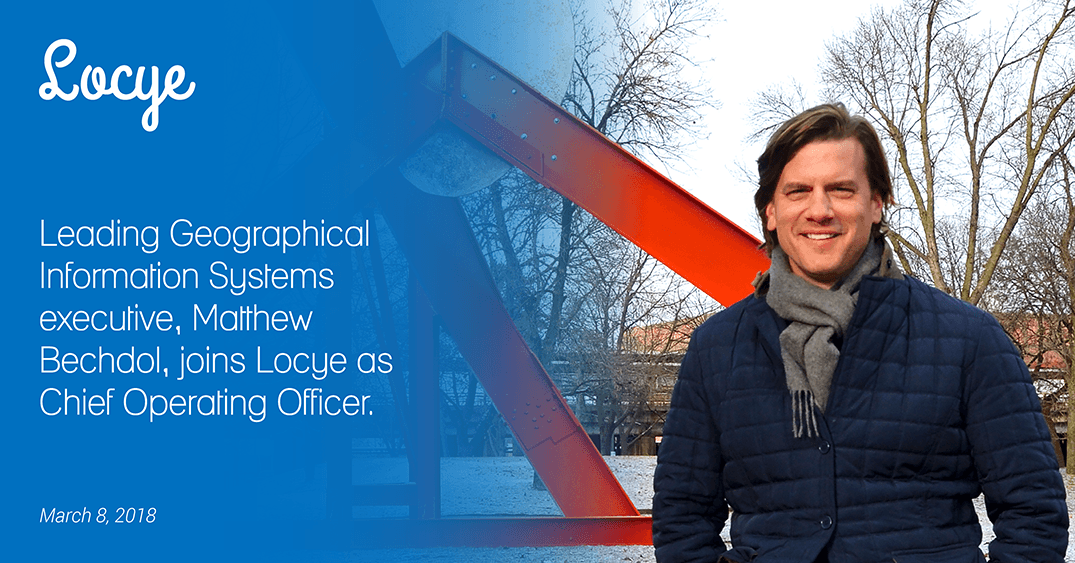
Matt is Locye’s COO. Before Locye, he successfully led for more than a decade, enterprise Geographical Information Systems (GIS) software sales and account management teams at Esri. His accomplishments at Esri include a $40M enterprise software licensing agreement with the USDA as well as a similar agreement with the U.S. Department of the Interior.
Prior to Esri, Matt served as a Remote Sensing Scientist at Global Science & Technology where he assisted in the acquisition and processing of GIS and hyperspectral data at NASA's Goddard Space Flight Center.
During the past two decades, Matt has founded a GIS consulting firm, taught GIS at George Mason University, served on several industry and community boards, and chaired local foundations.
He holds an MBA from Indiana University’s Kelley School of Business, a M.S. in Agricultural Economics from Purdue, a M.S. in Geography & Cartographic Science from George Mason, and a B.S. in Public Affairs & Environmental Science from Indiana University, Bloomington.

Sajjad is Locye’s CTO. Before Locye, he was a Geographical Information Systems (GIS) Technical Analyst at Esri where he was responsible for developing GIS software for Esri’s federal and commercial clients such as Johnson & Johnson, Lowe’s, U.S. Census Bureau, U.S. Dept. of the Interior, Smithsonian, FCC, Alexion Pharma, Acxiom, USPS, FAA, GSA, and USDA.
Prior to Esri, Sajjad served as a Sr. Implementation Consultant at Omniture (now Adobe) where he was responsible for implementing and extending a data analytics platform for Fortune 500 clients such as Verizon, Target, TIAA-CREF, Marriott, AT&T, News Corp., Cisco, Sabre, Clear Channel, and Freddie Mac.
In the past, Sajjad has founded multiple startups including a successful business group that grew to over 100 employees with projects in the manufacturing, real estate, agriculture, and technology domains.
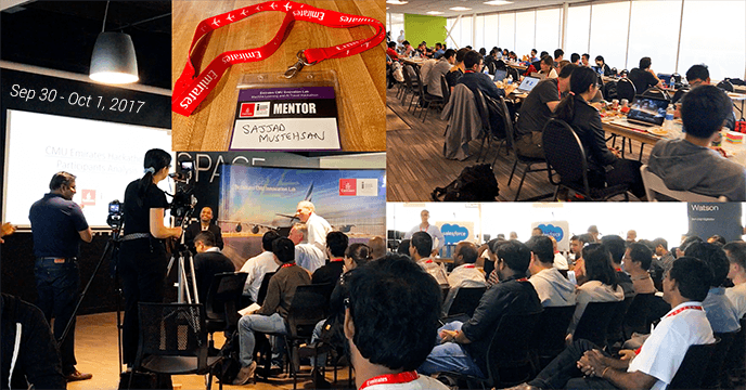
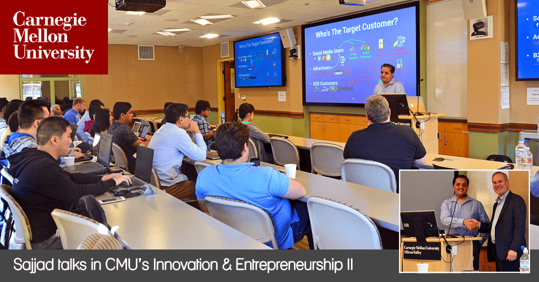
He holds a Master of Software Engineering degree from Carnegie Mellon University in Pittsburgh, PA and a B.S. in Information & Computer Science from the University of California at Irvine.